So, what are some of the data that we have?
We know who was on board:

The New York Times has a series of maps showing flight route/tracking data here. It's more detailed than this image (includes more precise time data on one map), but here's a basic overview:
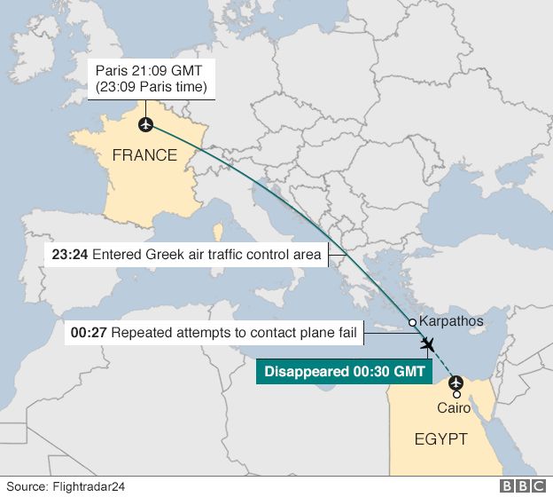
And here's the full data on where the plane had been recently:

There's data on the speed and altitude:
 |
| From wikipedia |
You can even play back the flight here: https://www.flightradar24.com/data/flights/ms804/#9c0b766
This site also provides downloadable tracking data -- for anyone.
Apparently some smoke sensors collected data shortly before the crash (hard to read, but you get the point). We don't know much about what this means yet, although I read in one report that had there been an sudden, big explosion there wouldn't have been time for this data to register.

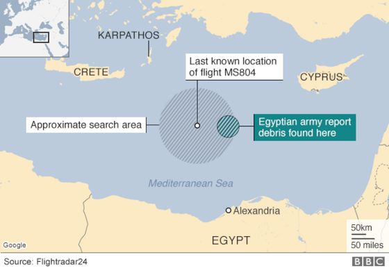
The search for the plane itself is on. Debris has been found, and data points are being amassed to determine where to search first:
So, shared with the public so far would be some general data about passengers, plane history, flight path, flight timeline, flight sensors, and debris location. Certainly the authorities have and are working with more data than this, but here we at least have a basic overview of just how important the data is going to be for both recovering the plane and determining the cause of crash.
No comments:
Post a Comment